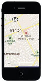
Students use their smartphones to improve quality of life in Trenton
A team of 30 TCNJ students used a tailored smart-phone “app” to engage in a “smart-phone mapping” pilot project, surveying and documenting the ongoing status of vacant, abandoned, and underutilized properties in The Historic District Redevelopment Area of Trenton.

Yogi Berra once said “You can observe a lot just by watching.”
The field observations made by a team of 30 TCNJ students who visited downtown Trenton and nearby neighborhoods in early October is a testament to this statement.
However, instead of just “watching,” the students did Berra one better and engaged in a little 21st-century observation: they tried their hands at “apping.”
Students used a tailored smart-phone “app” to engage in a “smart-phone mapping” pilot project, surveying and documenting the ongoing status of vacant, abandoned, and underutilized properties in The Historic District Redevelopment Area of Trenton. The app was specially designed to use the Trenton Council of Civic Associations’ format for data collection.
 The students included Bonner scholars from TCNJ’s Bonner Center for Civic and Community Engagement and first-year students fulfilling the College’s “Community-Engaged Learning” (CEL) day requirement, wherein Bonners work with first-year students with a variety of majors to engage the local community.
In addition to using mapping to note concrete ways to improve Trenton, the College hopes to use the pilot project in an effort to create more sophisticated community-engaged learning projects, said Director of the Bonner Center and Bonner Community Scholars Program Patrick Donohue.
“Our students will learn how to utilize cutting-edge technology while increasing the ability of our partners and the people they serve to make informed decisions about what they would like to see in their neighborhoods. This is a great extension of our existing partnerships,” said Donohue.
The students amassed a wide range of data, including photos of historic sites, photos of public art, an inventory of way-finding signs, downtown security-camera hand mapping, and personal reflections on public space and safety, as well as public space and safety reflections made possible by person-on-the street interviews. Using their smartphone uploads, they evaluated neighborhood property conditions.
“We conducted person-in-the-street interviews, photo-documented tourism attractions, and mapped online key African-American historic sites for the first time ever in Trenton,” said senior physics major Shaun Field.
By assessing ground conditions and making recommendations, the project participants hope to help business, neighborhood groups, and the police in their efforts to improve tourism, redevelopment, and quality of life in Trenton.
The students partnered with Trenton’s Shiloh Baptist Community Development Corporation (CDC) for the project. Last year, Shiloh Baptist CDC compiled similar field surveys for the near west side of Trenton. Jerome Harris, chief operating officer of Shiloh Baptist CDC, said the students’ smartphone mapping drastically cut the data collection and mapping time in comparison to the past.
“We are excited at the prospect of getting volunteers to help with our ongoing efforts—working smarter, not harder with this mapping technology,” Harris said.
The College’s Municipal Land Use Center (MLUC), which helps improve municipalities and communities with on-the-ground action, is also collaborating with Bonners and the Shiloh Baptist CDC on the project.
According to MLUC Executive Director Brian Reilly, who is teaching a class on “community mapping” this semester, this mapping project falls in line with MLUC’s mission.
“This pilot project is mobilizing the resources of a college campus toward impact in New Jersey community at a time when communities’ budgets are strapped,” explained Reilly. “We think mapping little-known or underutilized assets in NJ towns and cities could be a source of new tourism income at a time municipalities, and local small businesses need new sources of income.”
Posted on October 17, 2011

